Estimation of the distributions followed by the main meteorological
parameters.
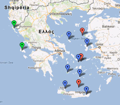
Locations which will be used for Workpackage1.
The areas
of study corresponding to wind data (land stations of the Hellenic National
Meteorological Service) were picked so to cover the west and the east part of
Greece, in order to check the differences mentioned earlier. For this reason, we
cover north and south Ionian Sea (Kerkyra and Kefallonia islands-green
indicators), as well as the whole Aegean from north to south (Chios, Skyros,
Mykonos, Milos, Santorini, Siteia and Souda-Crete with blue indicators).
Map of Greece
Back to the project's homepage.